
 Login
Login
 Stores
 Cart
Cart
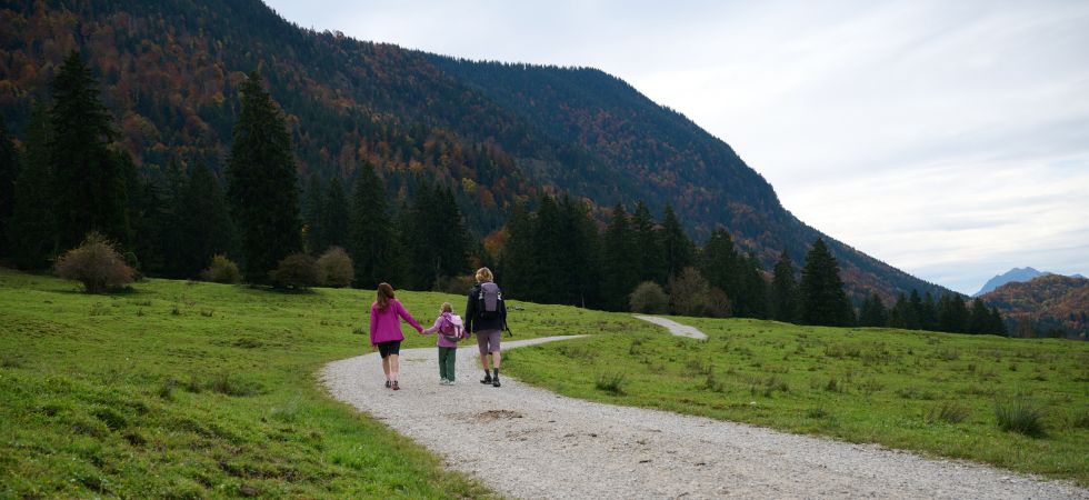
Whether you are heading into the mountains for the first time or getting back into hiking after a longer break, hiking for beginners starts before you take your first step on the trail. Good preparation makes all the difference. In this guide, we show you what really matters when you are just starting out: from the right hiking gear to smart route planning and some of the most scenic beginner friendly hikes around the Zugspitze.
The Zugspitze region around Garmisch-Partenkirchen is one of the most popular hiking areas in the Alps. Turquoise lakes, lush alpine meadows and striking peaks make it a fantastic place for beginners. Here, you will find relaxed starter hikes as well as your first alpine adventures when you feel ready for more.
Hiking Gear for Beginners
The right gear helps you stay comfortable, safe and happy on the mountain, even after several hours on the trail. You do not need to buy everything at once when you are starting out. But the basic hiking gear for beginners should fit properly and do its job from day one.
Hiking shoes
No piece of gear affects your hiking experience as much as the right pair of hiking shoes. Trainers or lightweight sneakers are not a good choice on rocky ground, damp trails or rooty paths. For easy to moderate hikes, a stable low cut hiking shoe with a grippy sole is often enough. If you are planning longer tours, carrying a backpack or hiking on uneven terrain, a trekking boot with ankle support is the better option.
Important: Do not test new shoes for the first time on a long hike. Wear them on a few shorter walks first. This helps you find out whether they really fit and reduces the risk of pressure points or blisters.
📌 Find out how to choose the right mountain boot!


Hiking clothing: the layering system
Weather can change quickly in the mountains. That is why the layering system is much more practical than wearing one thick layer. With several thin layers, you can easily adapt when you get warm, when the wind picks up or when temperatures drop.
Next to your skin, wear a base layer made from functional fabric or merino wool. Depending on the season, add a warm midlayer such as fleece. For the outer layer, a softshell jacket works well in dry conditions, while a waterproof rain jacket is essential when the weather is uncertain. On longer hikes, a rain jacket always belongs in your backpack. At higher elevations, it can be noticeably colder than in the valley, even on a sunny day.
📌 Discover outdoor clothing at Sport Conrad!


Hiking backpack and what to pack
For day hikes, a hiking backpack with a volume of 20 to 30 litres is usually enough. Make sure it sits comfortably and has both a chest strap and a hip belt. Even more important than the size is what you carry inside.
Your basic kit should include at least 1.5 to 2 litres of water per person, enough food, a first aid kit, a map or offline GPS app, sunscreen, warm layers, a headlamp and, on longer hikes, an emergency bivy bag. For food, carbohydrates are useful for quick energy, such as muesli bars, bread or dried fruit. Protein rich snacks like nuts, cheese or a sandwich help you stay full for longer. The emergency bivy bag is often forgotten, but it can be essential. An injury, thunderstorm or sudden change in the weather may mean you have to stay on the mountain longer than planned.


Hiking poles
Hiking poles are a smart support, especially for beginners. They give you more stability on uneven ground and can noticeably reduce strain on your knees during descents. On longer hikes, steep sections or tours with a heavier backpack, they can make a real difference. Telescopic hiking poles made from aluminium or carbon are especially practical. You can adjust them to your height and the terrain, and attach them to your backpack when you do not need them.


Essential hiking gear for beginners
- Broken in hiking shoes with a grippy sole, hiking socks
- Clothing: functional base layer, fleece or softshell, rain jacket, sunglasses, cap or hat, spare shirt
- Food and drink: at least 1.5 litres of water, depending on route length, refill options and temperature, plus fruit, trail mix, bars, bread and an emergency snack
- Navigation: compass, map or offline app such as Komoot or Outdooractive
- Safety: first aid kit, emergency bivy bag, whistle, headlamp
- Extras: sunscreen SPF 30+, power bank with charging cable, hiking poles
Tips for Beginners: How to Approach Your First Hikes
Mountain hiking is more than a long walk. Even easy tours require fitness, sure footedness, orientation skills and good preparation. That should not put you off. Quite the opposite: with a few basic rules, hiking for beginners quickly becomes a safe and rewarding experience.
1. Start slowly and build up realistically
When you are new to hiking, it is better to start shorter and finish with a good feeling than to overdo it on your first tour. Choose routes that are below your physical limit. This helps you get used to walking time, elevation gain, changing terrain and carrying a backpack.
As a rough guide, healthy beginners can usually manage hikes with up to around 400 metres of ascent. Sporty beginners can gradually try tours with up to 700 metres of ascent. Hikes with more than 1,000 metres of elevation gain in one day should only be attempted once you have some mountain experience and can assess your fitness well.
Important: Distance alone does not determine how difficult a hike is. A 10 kilometre route with 600 metres of ascent is much harder than 15 kilometres on flat ground. For hiking beginners, elevation gain, trail conditions and the descent are just as important as distance.
2. Choose the right terrain for beginner hikes
A good beginner hike is varied, well marked and technically simple. Wide hiking trails, forest roads, alpine pasture tracks and well maintained paths without exposed sections are ideal. At the beginning, choose routes where you can turn around or shorten the hike if needed.
When planning your route, look at these points:
🚶 Distance: 6 to 10 kilometres is often ideal for the first hikes.
⛰️ Elevation gain: Start with around 200 to 400 metres and increase gradually.
🥾 Terrain: Easy to walk trails are better than steep, slippery or rocky paths.
🧭 Signposting: Choose marked routes with clear navigation.
🏡 Hut or exit option: A hut, alpine pasture or village along the route adds extra safety.
The most enjoyable hikes offer variety: a lake, alpine meadow, viewpoint or small summit. After a few tours, you will quickly notice what suits you best. Maybe you prefer short and punchy hikes. Maybe you enjoy gentle scenic routes. Or perhaps longer, quieter tours are more your style.
3. Understand difficulty levels
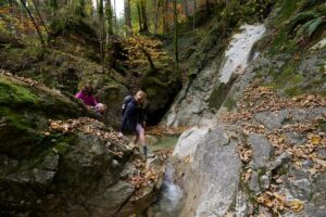
Two systems are especially useful when planning a hike: the SAC hiking scale and, in Bavaria, the colour coded trail markings. For beginners, simple and well marked routes are the best choice.
SAC hiking scale:
- T1: easy hiking trails, well marked, technically simple
- T2: mountain hiking trails, sometimes narrower, steeper or more uneven, manageable for beginners with some fitness
- From T3: clearly more demanding, often narrower or exposed, sure footedness required
- T4 to T6: alpine terrain, sometimes with scrambling sections, not suitable for beginners
Colour coded trail markings in Bavaria:
- 🔵 Blue: easy trails, usually wide, easy to walk and without fall risk
- 🔴 Red: moderate mountain trails, often steeper, narrower or rockier, sturdy hiking shoes and sure footedness required
- ⚫ Black: difficult mountain trails, often steep, rocky or exposed, only for hikers with alpine experience
For your first tours, choose T1 or T2 routes, or blue marked trails in Bavaria. This is the safest way to ease into hiking in the mountains.
4. Plan your walking time realistically
Beginners often underestimate how long a hike will take. As a rough rule, you can calculate around 300 metres of ascent per hour, 500 metres of descent per hour and about 4 kilometres of horizontal distance per hour. This gives you a useful estimate for walking time.
5. Take the weather forecast seriously
Weather is a key factor in the mountains. Even if it feels warm and settled in the valley, wind, rain, fog or thunderstorms can quickly become a problem higher up. Always check the forecast for the specific mountain area, not just for the nearest town in the valley.
Pay special attention to thunderstorm risk, wind, temperature, precipitation and visibility. If the forecast is uncertain, choose a shorter hike and plan to return early. If dark clouds build up, you hear thunder or the wind suddenly increases, turn back or seek shelter in time. The summit will still be there another day.
6. Navigation: do not rely only on your phone
Even on easy hikes, you should know where you are and how to get back. An offline map on your smartphone is very useful, but your battery can run out, the device can get wet or the GPS signal can be inaccurate. Download the route before you start and ideally carry a paper map or printed route description as a backup.
7. Pack the right food and drink
Even on easy hikes, your body needs energy and fluids. For a day hike, pack at least 2 litres of water per person. On hot days, long climbs or routes without refill options, you may need more. As a rough guide, 0.5 litres per hour is sensible on sweaty hikes.
For food, a mix of quick carbohydrates and more filling snacks works best. Muesli bars, bananas, dried fruit or bread provide fast energy. Nuts, cheese, sandwiches or protein rich snacks keep you full for longer. Eat small amounts regularly rather than waiting until you are really hungry. This helps keep your energy levels steady.
8. Hiking the Zugspitze as a beginner: be realistic
The region around the Zugspitze is beautiful and offers many routes that are ideal for beginners. But if you are looking for beginner hikes in the Zugspitze region, it is important to make one clear distinction: hiking around the Zugspitze is not the same as climbing the Zugspitze itself.
For beginners, easy hikes around Garmisch-Partenkirchen, Ehrwald, Lake Eibsee or through the Reintal valley are a good place to start. The classic routes to the Zugspitze, such as the Reintal route from Garmisch or the Gatterl route from Ehrwald, are long and physically demanding. In summer, via ferrata gear and traction spikes are not necessarily required on these routes, but you still need very good fitness, sure footedness, stable weather and careful planning. They are not suitable for your first hike. After several successful mountain hikes, however, they can become a rewarding goal.
Easy Hikes in Bavaria for Beginners
Bavaria is a great place to start hiking. Especially in the Bavarian Prealps and around the lakes, you will find many routes with beautiful scenery that are not too technically demanding. Still, even easy hikes should match your fitness level, the weather and the season.
Lakeside hikes
Lake hikes are perfect for beginners. The trails are often well maintained, elevation gain is usually moderate and you still get a real mountain feeling. Particularly beautiful options include routes around Lake Eibsee, Tegernsee, Schliersee, Spitzingsee and Königssee. Many routes can be shortened or combined with a hut or lakeside stop.
For beginners hiking in Bavaria, circular routes with little elevation gain are especially suitable. Still, wear sturdy footwear, as lakeside paths can be rooty, rocky or slippery after rain.
Easy mountains for your first summit
If you are planning your first real mountain hike, choose a summit with moderate elevation gain, good trails and an easy descent option. Routes with around 300 to 700 metres of ascent are ideal, depending on your fitness. It is even better if a cable car gives you the option to shorten the hike or descend more easily.
Good beginner mountains offer a real summit experience without being technically difficult. You still need realistic timing, enough water and an early start, especially in summer.
Hut hikes for beginners
A hut as your destination makes a first hike especially motivating. You have a clear goal, can take a proper break and enjoy a stop along the way. For beginners, huts, alpine pastures or mountain inns are best when they can be reached via wide forest roads or well marked hiking trails.
Always allow enough time for the way back. After a longer break, the descent can feel harder than expected. Also check opening times in advance, as not every hut is open year round.
Easy Routes in the Zugspitze Region for Hiking Beginners
The Zugspitze region offers much more than the climb to Germany’s highest summit. Around Garmisch-Partenkirchen, Lake Eibsee and the surrounding valleys, you will find many routes that are well suited to hiking beginners. The best part: you are quickly surrounded by mountain scenery without having to plan a demanding summit tour straight away.
Three beginner friendly hikes in the Zugspitze region:
- Eibsee circular trail, 7.5 km, approx. 2 hours
The 7.5 kilometre loop around the turquoise Lake Eibsee at around 1,000 metres is an ideal first hike. The trail is well marked, barely exposed and offers one of the region’s most famous views of the Zugspitze. Elevation gain is less than 100 metres. Parking is available near the Eibsee cable car station, and the lake can also be reached by train.
- Partnach Gorge, valley route, approx. 1.5 hour circular walk
The Partnach Gorge near Garmisch-Partenkirchen is one of Bavaria’s most impressive natural sights. The secured trail leads through a dramatic rocky gorge where the mountain stream has carved deep into the stone. The path can be wet and requires sturdy footwear, but it is otherwise manageable without mountain experience. Entry is fee based. It is perfect for a half day trip or as a scenic start before a longer hike.
- Wank, Garmisch-Partenkirchen, approx. 700 m ascent, 3 to 4 hours
The Wank, at 1,780 metres, is one of the classic local mountains of Garmisch-Partenkirchen. With around 700 metres of ascent, it is an ideal first real mountain hike for well trained beginners. If you want to save your legs, you can use the Wank cable car for the descent. At the top, you are rewarded with wide views of the Zugspitze, the Wetterstein range and the valley around Garmisch-Partenkirchen.
Hiking Up the Zugspitze as a Beginner: Is It Possible?
The Zugspitze, at 2,962 metres, is Germany’s highest peak. If you want to reach the summit on foot without needing a via ferrata or alpine climbing experience, there are two realistic options: the route through the Reintal valley from Garmisch-Partenkirchen and the route via the Gatterl from Ehrwald. But a high alpine tour is not a beginner hike in the classic sense. Mountain experience, fitness, sure footedness and a head for heights are required on both routes. The weather must also be carefully considered when planning.
Both hikes are safest when planned as a two day tour with an overnight stay in a hut. They are possible in one day, but physically very demanding.
Route 1: Reintal from Garmisch-Partenkirchen
- Start: Olympia Ski Stadium Garmisch-Partenkirchen, 760 m
- Summit: Zugspitze, 2,962 m
- Distance: approx. 22 km one way
- Walking time: approx. 8 to 10 hours, depending on experience
- Difficulty: moderate, technically the easiest summit route to the Zugspitze
- Huts: Bockhütte, 1,052 m, Reintalangerhütte, 1,369 m, Knorrhütte, 2,052 m
The Reintal route is the longest but technically easiest ascent to the Zugspitze. From the Olympia Ski Stadium, the trail first leads through the spectacular Partnach Gorge. If you want to avoid the entrance fee and the crowds, you can turn off earlier and take an alternative route to the Bockhütte. After that, a wide, well marked trail leads via the Bockhütte to the Reintalangerhütte. Up to this point, the tour can be considered easy, with just over 500 metres of ascent over 14 kilometres.
The real climb begins after the Reintalangerhütte. From there to the Knorrhütte at 2,052 metres, the trail gains another 700 metres of elevation over around 6 kilometres. If you split the tour over two days, this is the best place to stay overnight. On the second day, the route continues across the Zugspitzplatt to Sonnalpin and then on to the summit. The final section follows a partially cable secured mountain trail and requires sure footedness. It leads across a steep slope of scree and rocky terrain. Snowfields can also make the ascent more difficult.
❗ Especially as a beginner, you should check the conditions carefully before the tour. Find out about the weather, snow conditions, thunderstorm risk and current trail conditions before your planned ascent, for example from huts, mountain railways or local route platforms. The final section towards the summit is steep, demanding and classified as a black mountain trail. You need sure footedness, a head for heights and enough energy left in your legs. If you feel unsure, it can be sensible to use via ferrata gear for additional safety or to hike with experienced companions or a guide. In snow, wet conditions or poor visibility, it is better to turn around or postpone the tour.
Descent: Take the railway back towards Garmisch-Partenkirchen, using the cog railway to Zugspitzbahnhof. From there, it is about 30 minutes back to the starting point.
Route 2: Gatterl from Ehrwald, Tyrol
- Start: Ehrwalder Almbahn valley station, Ehrwald, Tyrol, approx. 1,000 m
- Summit: Zugspitze, 2,962 m
- Distance: approx. 11 to 13 km
- Walking time: 6.5 to 8 hours, depending on experience
- Difficulty: moderate to difficult, with some secured sections
- Huts: Ehrwalder Alm, Knorrhütte, 2,052 m, Sonnalpin, 2,576 m
The Gatterl route starts in Ehrwald on the Austrian side and approaches the Zugspitze from the southwest. It is more varied, but also technically more demanding than the Reintal route. In return, you get alpine meadows, mountain pines, karst landscapes and excellent views of the Wetterstein range. With the Ehrwalder Almbahn, you can save the first 400 metres of ascent.
From the mountain station of the Ehrwalder Almbahn, the Max Klotz trail leads via the Brandjoch and Feldernjöchl to the Gatterl at 2,024 metres. This historic crossing marks the border between Austria and Germany. Just before the Gatterl, there is a short chain secured section where you need to use your hands for support. Depending on the season and conditions, snowfields can also make the route more difficult.
From the Gatterl, the trail continues through karst terrain to the Knorrhütte, then across the Zugspitzplatt to Sonnalpin and from there towards the summit, as on the Reintal route. For this route, the Gatterl combination ticket is practical, as it includes the ascent with the Ehrwalder Almbahn, the descent with the Tiroler Zugspitzbahn and optionally the glacier cable car.
💡 Both routes are demanding objectives for advanced, very fit beginners with some mountain experience. They are not starter hikes. If you are just beginning to hike, start with easier routes in the Zugspitze region, such as the Eibsee circular trail, the Partnach Gorge or the Wank, and gradually work your way up to longer mountain tours.
Ready for Your First Hike?
The right gear is the first step towards a safe and enjoyable start to hiking. In the Sport Conrad shop, you will find hiking shoes, hiking backpacks, functional clothing and everything else you need for your first tours. In our three stores in Bavaria, hiking beginners can also get professional advice on choosing the right equipment.