
 Login
Login
 Stores
 Cart
Cart
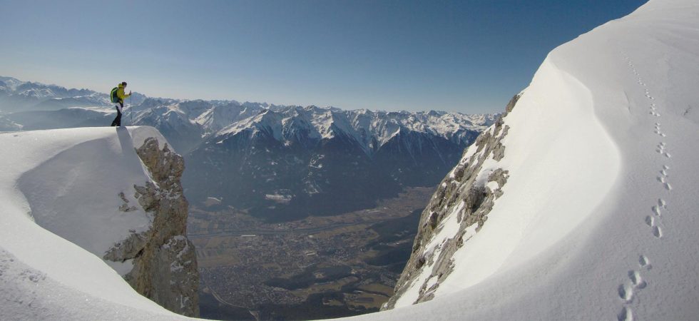
The ski touring season has just begun and the question arises which routes are best to take. The region around the Werdenfelser Land offers a variety of fantastic ski tours for beginners and experts – from easily accessible routes, that seem even doable with a slightly tense avalanche situation, to steep slopes and narrow couloirs. In addition to great tours, you can find a lot of cozy huts in this area where you can stop by for a chilled drink before heading back down to the valley again.
In this post, you can discover the 5 most beautiful ski tours around the Werdenfelser Land and get all the details you need for a great outdoor adventure.
Grünstein Tour In the Mieminger mountains
Starting in Biberwier, the Grünstein tour offers a high altitude and amazing downhill slopes. This demanding ski tour is totally worth the effort – breathtaking scenery and views of the Ehrwalder valley are waiting for you. The route also allows for several variations and chances are high to find untouched terrain.
Itinerary
Starting point of the tour is one of the parking lots at the ski resort in Biberwier at 1010m. From here you can either follow the slopes or optionally use the ski lifts to get to the Marienbergjoch – around 750m in altitude. Continue southeast to the Hölltörl on 2130m. Ambitious tourers have the possibility to go a little bit further to the Höllkopf on 2194m. Once there the first descent follows westwards to the so-called “Hölle” (“hell”) to 1758m. The second ascent starts northeast through the Höllreise to the Grünsteinscharte on 2272m. This sunny spot is often used as a short break for the first snack to get some new energy for the further hike. First, however, the tour goes downhill again and you need to cross northeast under the Griesspitzen where you reach about 2150m. Do not cross too high because of the avalanche danger! Now you ascend to Hinteres Taja-Törl on 2259m – if the conditions are good, you can optionally also hike the second summit, the Hinterer Tajakopf on 2408m.
Just follow the summer path northwards through rocky terrain – light crampons can be useful. The amazing view definitely is worth the effort! The longest descent of the tour follows in northeast direction through the Brendlkar and then from 2000m northwards to the forest road (Via Alpina – Red Trail) to 1600m. Follow this road to the Ehrwalder Alm, where you can have a well-deserved break. From the Ehrwalder Alm you can ski down the piste to the bottom station of the Ehrwalder cable car. If you do not have parked a second car there in advance or someone who picks you up, you can easily take the public bus who brings you back to Biberwier.
All details at a glance
- Level of difficulty: hard
- Steepness: > 40°
- Avalanche danger: high
- Ascent: 1030 m (1750m)
- Descent: 1780 m
- Distance: 16.9 km
- Exposure: NW, S, E, SE, N, NW
- Duration: 2.5-4 h
- Best Time: February & March
The Alpspitze Above Garmisch-Partenkirchen
The Alpspitze is certainly THE mountain above Garmisch-Partenkirchen. With its perfect pyramid shape, the Alpspitze attracts many climbers throughout the year. Outdoor enthusiasts can take the Alpspitz cable care, which gives you an easy ride up to 2020m altitude.
Itinerary
The most comfortable option starts with a cable car ride to the Osterfelderkopf on 2020m. After reaching the top, go down the slope to about 200m above the valley station of the Bernadein t-bar lift on 1500m. Here you turn through the forest southeast towards the Stuiben hut. Follow this path for about 500m, keeping an eye on signs regarding protected nature area, and then turn south. Go upwards through the Stuiben forest for about 200m and then continue in a westerly direction. At about 1950m you can see the frozen Stuiben lake on your left-hand, before continuing on a short scarp towards the Bernadeinkopf. The tour goes on through a cirque in northwestern direction until the east ridge to the Alpspitze. If you don’t feel comfortable doing the wild descent down the east face, you can leave your skis at the beginning of the ridge at 2265m and conquer the peak along the summer path over the ridge – crampons are often very useful.
The downhill on the east face can only be recommended under very good snow conditions and even for experienced skiers, it might be an exciting run. Afterwards, the descent follows the ascent route to the valley station of the Bernadein t-bar. You can either take the t-bar or walk around 300m back up to the Osterfelder descent. The run down to the valley follows and the exhausting part is done. As a reward, you can stop by at the Hochalm, before taking the Olympia or Kandahar downhill back to the parking lot.
All details at a glance
- Level of difficulty: hard
- Steepness: > 40°
- Avalanche danger: high
- Ascent: 1115 (+ 300) m
- Descent: 2650 m
- Distance: 17.2 km
- Exposure: N, E, SE
- Duration: 4 h
- Best Time: February, March & April
Ochsenälpleskopf In The Allgäu Region
The Ochsenälpleskopf in the Ammertal offers a peaceful atmosphere and fantastic descents. This tour is particularly recommendable when there is a lot of snow and a good snow-basis already – otherwise, the southeast forest runs at the beginning are only half as much fun. Especially on cold days, you can enjoy a few rays of sunshine in the morning. The starting point of the tour is at the hotel Ammerwald.
Itinerary
From the parking lot at the Hotel Ammerwald, you follow the forest road behind the hotel northwestwards in the forest. Follow this road for a few meters until you reach a small hut and turn left onto the Schützensteig. It leads in serpentines up the slope in a northwesterly direction until you reach the saddle at 1431m where a hunter’s hut stands. From here, climb south through the forest, past another hut on 1575m until you reach the east ridge up to the Ochsenälpeskopf. Now the steepest part, which leads to the summit on 1905m, has to be overcome with kick turns.
The standard descent first follows the ascent route but instead of turning left to the hut, you continue eastwards on the ridge until you reach the Schützensteig just below 1200m. Follow it back to the parking lot.
All details at a glance
- Level of difficulty: medium
- Steepness: 35°
- Avalanche danger: medium
- Ascent: 820 m
- Descent: 820 m
- Distance: 9.4 km
- Exposure: N, E, NE
- Duration: 3 h
- Best Time: January, February & March
Hohe Munde East Summit
Also known as the freestanding giant, the last mountain at the eastern end of the Mieminger mountain range – the Hohe Munde -immediately catches your eye on your way to Innsbruck. The ascent on the eastern flank is quite demanding and due to the steep descend, this mountain also brings a high avalanche risk with it. However, you are rewarded with an incredible view of the beautiful Inn Valley. Especially in spring with slushy conditions, this tour is a true pleasure. You should start early in the morning and should make sure that the snowpack has completely frozen overnight. Crampons are recommended.
Itinerary
Starting point of this tour is the parking lot at the Rauth Hut in Moos on 1178m. Follow the old skiing slope to the Rauth Hut, which is usually open for a quick stop but is also open for an overnight stay until Easter. Go past the hut on the left side and soon keep to the northwest. Continue right past the edge of a hollow and a small private hut. Here the summer path begins – you will probably see tracks. It leads to the southwest through pine fields. At 2090m keep again to the northwest and follow the ridge up where it is the shallowest. After reaching 2540m continue to the southwest – the last few meters to the summit on 2662m. The descent runs along the ascent route.
ALTERNATIVE ROUTE (difficult): If you haven’t had enough on the east summit and there are good conditions, you can continue to the Hohe Munde west summit. First, go down the slope between the two peaks and then up the narrow ridge. At the steep passage, it is perhaps better to hike without skis. Other than that the summit is easy to find, as you only have to follow the ridge. Again, the descent runs along the ascent route and should not be underestimated. If there is ice or hard firn, crampons are recommendable.
All details at a glance
- Level of difficulty: medium
- Steepness: 45°
- Avalanche danger: high
- Ascent: 1413 m
- Descent: 1413 m
- Distance: 8.4 km
- Exposure: S, SE
- Duration: 4 h
- Best Time: March & April
Steinkarspitze in the Lech valley
The Lech Valley offers many beautiful ski tours – one of them is located in Kelmen. The ascent to the Steinkarspitze starts already on 1450m. This high entry level makes ski touring here even possible in the early winter. The tour itinerary below describes one of the various possible descents – starting on the northern side of the Kelmer Joch this downhill run usually offers a lot of great powder due to the shady location.
Itinerary
Starting point is the parking lot directly at the junction to Kelmen. From here you go northwards over the meadow and past Kelmen to the forest road. Follow this road for two bends up to 1515m and directly in a right-hand bend, turn left into the forest. Continue through the Egg forest until you cross the forest road again. The route now leads through forest and meadow sections northwest to the Kelmer Joch. From here either go further northwest, crossing the slope at around 1880m to the Steinkar, or directly take the first descent on the north side of the Kelmer Joch down to 1780m. After the descent put your skins on again and keep northwards for around 300m. Now you ascend westwards along the eastern flank up to the summit.
The descent initially runs along the ascent trail and then – depending on the avalanche danger – turns to the southeast, leading to the slope of the Steinkar and the first basin at about 1890m. The downhill run continues with a crossing under the foothills of the Knittelkarspitze back to the Kelmer Joch. From there, follow the ascent trail back to the valley.
All details at a glance
- Level of difficulty: easy
- Steepness: 35°
- Avalanche danger: medium
- Ascent: 931 hm
- Descent: 931 hm
- Distance: 6.6 km
- Exposure: SE, E, N, S
- Duration: 3.5 h
- Best Season: December, January, February & March
The author does not take any liability for the information presented. Touring enthusiasts should always be aware of the risks and regularly educate themselves through courses (avalanche safety training, etc.).